The First Iteration

By Dongsei Kim
"…borders have become in recent years an important concern of research and political and artistic practice. They are sites in which the turbulence and conflictual intensity of global capitalist dynamics are particularly apparent. As such they provide strategic grounds for the analysis and contestation of actually existing globalization."
—Mezzadra and Neilson, Border as Method, 2013 (1)
Unsettled Korean War: The 38th Parallel Division Post-Japanese Colonial Rule
On July 27th 1953, Lieutenant General William K. Harrison Jr., representing the United Nations Command (UNC) on one hand, and General Nam Il representing the Korean People’s Army and the Chinese People’s Volunteer Army on the other hand were present at Panmunjom located near the 38th parallel line [Image 1]. After years of negotiations they signed an armistice agreement to end the Korean War. The two Koreas had come full circle after a devastating three-year war that claimed more than two million lives. The unforgiving, straight 38th parallel line that bisected the Korean peninsula was fiercely fought over during the war. Despite numerous pushes and pulls, and millions of lives lost, the armistice line remained more or less identical to the 38th parallel line that preceded the war.
The Allied victory of World War II ended the Japanese colonial rule over Korea. However, this did not mean a fully independent Korea from forces of imperialism. Immediately after the surrender of Japan in 1945, United States assumed control over the southern half of the peninsula, and the Soviet Union over the other half. The U.S. and the U.S.S.R agreed to divide the peninsula into two, to alleviate fears on both sides of the other party having a full influence over the entire peninsula. This agreement eventually became the prelude to the Cold War.
The First Iteration: A Critical Mapping
How we understand territories and nation-states—more importantly how we imagine them—depend on how we map them. This reciprocal relationship between the formation of nation-state and mapping has been well discussed in the past. Apart from the influential ‘Agency of Mapping: Speculation, Critique and Intervention’ by landscape architect James Corner, numerous recent publications discuss this relationship between mapping and power. Publications such as The Cartographic State: Maps, Territory, and the Origins of Sovereignty by Jordan Branch (2); Close Up at a Distance: Mapping, Technology, and Politics by Laura Kurgan (3); and The Birth of Territory by Stuart Elden (4) each address this reciprocal relationship between mapping and power. They all highlight the complex reciprocal relationship between the two. These publications highlight not only the potency of maps in serving power, but equally point to the possibility of deploying mapping to radically re-imagine the nature of nation-states.
This critical mapping of the DMZ between North and South Korea interrogates this very possibility. This speculative ‘First Iteration’ research aspires to be a harbinger for subsequent speculative projects. As a first step, this research project aims to provide multiple perspectives to the current discussions around the DMZ and its future. This mapping attempts to construct robust platforms where pluralistic imaginaries can be projected to examine DMZ’s full potentials. Moreover, it aspires to expose and bring to surface what is latent.
The ‘First Iteration: Uncovering the Agency of Unknown Armistice Maps’ (5) builds on the research animation ‘A Construct The Koreas (Never) Made Together: Deconstructing the DMZ For The Imaginary’ (6) that contributed to the Golden Lion award winning Korean pavilion’s exhibition at the 14th Venice International Architecture Exhibition. This ‘First Iteration’ mapping project specifically interrogates how political negotiations are choreographed through visual means, such as maps, and what they often overlook. To highlight this, visual components of the map are contrasted with other important, yet often overlooked important aspects, such as the experiences of people who inhabit the border spaces on a daily basis.
More significantly, this first iteration makes the mostly unknown 1953 armistice agreement maps readily available to the public. Written in English, Korean, and Chinese, the entire text of the armistice agreement is widely available in print and online. Most of the publications that discuss the DMZ include parts of the agreement text or the complete text. However, although the text of the agreement frequently refers to the ‘attached maps’ in ‘Volume II’ of the agreement, none of the sources display nor include these maps (7).
Spatializing the Division and the Emerging Void
The 1953 armistice prescribed a Military Demarcation Line (MDL), from which both opposing forces would withdraw by two kilometres, to establish a four kilometre wide Demilitarized Zone (DMZ). Even after its establishment, the two sides never ratified a peace agreement, instead observing an extended ceasefire, but remaining at war. Furthermore, severe limits imposed to this zone enabled the DMZ to eschew rapid urbanization commonly found elsewhere in the Korea peninsula. More than sixty-years of confrontations and unintentional absence of significant human activities has transformed the DMZ into a no man’s land. This no man’s land, sometimes referred to as an ‘involuntary park,’ has also become a sanctuary for many endangered species not found elsewhere within the Korean peninsula. In contrast to the peaceful image where nature takes over, ongoing military conflicts and ideological competitions has constructed an image of the DMZ—according to former U.S. President Bill Clinton—as the “scariest place on earth.”
Some of the ‘attached maps’ illustrated in this mapping project are originally part of the “Volume II - Maps of the Armistice Agreement” that accompanies the “Armistice Agreement - Volume I, Text of Agreement.” In the “Text of Agreement,” Article 1-1 describes how the Military Demarcation Line (MDL) will be fixed in the center and how both opposing forces will withdraw two kilometres from this line to establish the DMZ (8). While these ‘attached maps’ are frequently referred to, they are overlooked in many of the publications that discuss the armistice. It seems significant to point out that the important first parts of the agreement use spatial choreographing to delineate political entities. This again illustrates the potency of maps and how they aid producing such physical and political space. There is no doubt these maps had an immense impact on the two Koreas over the past six decades.
The Armistice Text and the Missing Maps of the Armistice
Article 1-2 states, “The Military Demarcation Line is located as indicated on the ‘attached map’ (Map 1).” (9) Further, Article 1-3 states, “The Demilitarized Zone is defined by a northern and a southern boundary as indicated on the ‘attached map’ (Map 1).” Nevertheless, as discussed earlier, none of the publications that discuss the armistice text accompanied these ‘attached maps.’ These maps were difficult to locate. After an extensive search for these maps across numerous libraries, archives, and online resources, a set of these maps were located at the U.S. Government’s National Archives and Records Administration in D.C. (10) These twenty-two large detailed colour maps range in size between 1040 x 530 mm and 730 x 530 mm. One of the main reasons why these maps have been omitted in most publications might be due to their rather large size and obvious restrictions on military classifications.
The primary purpose of this first iteration – disseminated through an exhibition in Berlin – was to uncover and make public these relatively obscure Armistice Agreement maps. The exhibition made these maps more accessible for further research and debate. This first iteration focuses on introducing and understanding the first nine maps of the twenty-two maps, maps 1-1 to 1-9. These maps depict the DMZ at a scale of 1:50,000. They vividly illustrate how the imagined Military Demarcation Line (MDL), the Northern Limit Line (NLL), and Southern Limit Line (SLL) are inscribed on to the territory rather abruptly. On one hand, the ‘First Iteration’ explores the agency of such maps in shaping these political spaces. On the other, it exposes the disjunctive relationship between this reductive ‘line on the map’ and the complex ‘reality’ on the ground through juxtaposing the two ‘realities.’
Juxtaposing 62 years: 1953 and 2015
A sharp-edged shield can be used for self-defense, but it can be a lethal weapon when deployed carelessly.
- Chen, Asia as Method, 2010 (11)
Juxtaposing the armistice maps produced in 1953 with Google Earth satellite images of identical locations produced in 2015 reveals the contradictory and complementary nature of maps and how they represent territories (12). The incongruous relationships between the real and the represented, exposure and concealment, and accentuated and omitted are ripe for further interrogation and imagination. Such juxtapositions reveal the contradictory and complementary nature of maps and how they represent territories. They further disclose the reciprocal relationship between maps and nation-state formations. By understanding the very potency and limits of mapping processes we can start to question the representational objectiveness or how close to ‘reality’ a map is. More importantly, mapping these border territories through novel perspectives, we can start to fundamentally question the nature of borders, and how they act as instruments in conceiving nation-states and their subjects.
Activating the Sensorial and Synaesthesia
The form of objects is not their geometrical shape: it stands in a certain relation to their specific nature, and appeals to all our other senses as well as light.
- Merleau-Ponty, Phenomenology of Perception, 1962 (13)
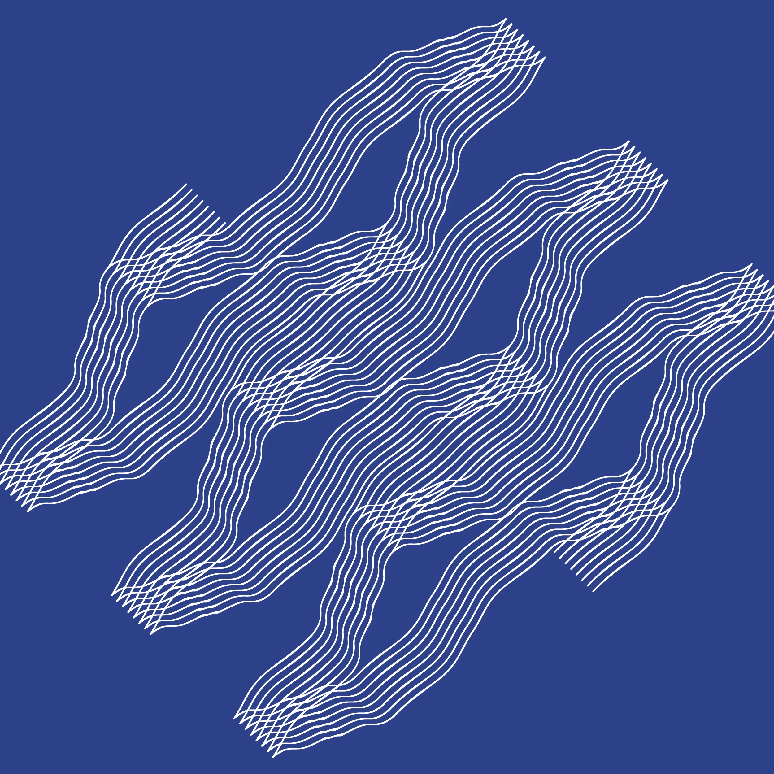
The interpretive component [Image 2] of this iteration attempts to open up latent potentials of the Armistice Agreement maps and its represented territories. This activation is provoked through accentuating senses and associated human subjectivities. The interpretive component activates the mostly overlooked sensorial experiences of a typical map. This activation attempts to expand the understanding of the DMZ, but more importantly is a confrontation to normative ways of representing thus imagining contested border territories.
For example, words and texts in the following quotes that crisscross over the interpretive mapping at various angles attempt to activate different senses. Layered on top of the deconstructed and reconstructed ‘armistice’ maps, they combine the dominant visual component of a typical map with other senses that amplify new synthesized experiences, emotions, and memories. This conflation of visual and other senses attempts to shift the audiences’ understanding of the contested DMZ beyond its impasse. Synaesthesia informs this conflation of visual and other senses. Synaesthesia was often discussed by Maurice Merleau-Ponty to emphasize the importance of senses often displaced by scientific knowledge, such as the dominant ‘objective’ maps in this case (14). Synaesthesia is often deployed in literature to combine or connect different senses to uncover the richness of our reality’s phenomenological complexities. Synaesthetic devices in the map attempts to do just that. Texts such as below included in the maps evokes auditory senses to animate the otherwise muted maps:
Ka-Pow! Pow! RAT-TA-TA-TA! RAT-TA-TA-TA! The closer you get to the Joint Security Area (JSA), Panmunjom, within the DMZ, the more gunshots are heard from nearby military bases. This heightens the tension for its visitors.
Blam! Another victim of the misplaced landmine is added to the thousands sacrificed so far. North and South Korea are two of the 35 states that have not signed the Ottawa Treaty, an Anti-Personnel Mine Ban Convention. 162 states have signed and ratified the Mine Ban Treaty since its conception in 1997.
Time in Flux: Evoking Memories, Emotions, and the Visceral
Through adding these other senses to the, otherwise, visually dominated map, the ‘First Iteration’ attempts to connect the DMZ to the spectators’ own everyday life experience. This component of the map interrogates the potency and limits of these visually dominated mapping apparatuses. An additional set of texts below the juxtaposed maps [Image 4 & 5] instigates reflections on non-physical elements of a border territory beyond its physical form. Numbers and statistics invisible in the maps prompt memories, emotions, and the visceral facets of the DMZ. They are an attempt to encourage the spectators to relate and connect to the DMZ with their own everyday existence:
62 years have passed since the Armistice Agreement was signed at ‘Panmunjom, Korea at 1000 hours on 27th day of July, 1953 in English, Korean, and Chinese, all text being equally authentic’ (15).
903.8 km2 area of the DMZ is close to the size of Berlin at 891 km2 (16).
580 m is the shortest distance between the North and South Korean military guard posts located in the North-East end of the DMZ. Both Korea’s military installations are in violation of the Armistice Agreement (17).
Being aware of mapping’s instrumentalities help us to uncover latent catalysts in these ‘attached maps.’ It further reveals multiple realities of the often universalized DMZ. This new knowledge could help us discover additional platforms that could engender novel imaginations. This iteration amplifies mapping’s role to provoke and engender new debates for the DMZ. These combined nascent steps within the long-term project add to the existing primary sources for further research and interrogations.
Lastly, this first iteration becomes a steppingstone between the previous animation work and other subsequent speculative iterations. If we understand the DMZ as an indispensable constituent of what Paik Nak-Chung refers to as the ‘division system,' (18) ceaseless engagement with the DMZ becomes additionally important. In this sense, this iteration can be understood as a form of ‘self-exploration’ that Paik suggests to be essential in overcoming the Korean division:
…in discussing the division system (division of the Korean peninsula) is to show that we must free ourselves from the obsession for finding “the correct answer.” Such obsession certainly is not confined to the issue of the division system, but I believe that the crucial part of the project for overcoming the division system consists in willingly undertaking efforts for self-exploration and self-renewal, based upon a keen recognition that the very consciousness of those who believe they have the correct answers for overcoming the division is seriously distorted by that system.
- Paik, The Division System in Crisis, 2011 (19)
‘First Iteration: Uncovering the Agency of Unknown Armistice Maps’ essentially deconstructs and reconstructs the underexposed armistice maps of the DMZ for novel interpretations. By interrogating the relationship between the ‘line drawn on a map’ and the disjunctive spatial result produced over time, it helps us to rethink the habitual relationship between borders and their maps. These maps further activate senses, emotions, memories, and human subjectivities that examine the impacts of borders on individual and collective human psyche. Moreover, in doing so these ongoing mapping projects provoke a critical rethinking of nation-states and how border apparatuses operate to constantly sustain them.
Endnotes
(1) Sandro Mezzadra and Brett Neilson, Border as Method, or the Multiplication of Labor (Durham and London: Duke University Press, 2013), 4.
(2) Jordan Branch, The Cartographic State: Maps, Territory, and the Origins of Sovereignty, (Cambridge: Cambridge University Press, 2014).
(3) Laura Kurgan, Close Up at a Distance: Mapping, Technology, and Politics, (New York: Zone Books, 2013).
(4) Stuart Elden, The Birth of Territory. (Chicago: University of Chicago Press, 2013).
(5) “First Iteration: Uncovering the Agency of Unknown Armistice Maps,” (print on canvas, 4756 x 841 mm) an exhibition project with Jack Isles (assisted with illustrations) in the Making Border: Afterimages and Projections group exhibition at DNA Gallery, Berlin, Germany, 2015, builds on top the research animation “A Construct The Koreas (Never) Made Together: Deconstructing the DMZ For The Imaginary” by Dongsei Kim, 2014.
(6) Dongsei Kim, “A Construct The Koreas (Never) Made Together: Deconstructing the DMZ For The Imaginary,” in The Crow’s Eye View: The Korean Peninsula, (Venice, Italy: 14th International Architecture Exhibition, June 7 to November 23, 2014)
(7) Kim, Dongsei. “Border as Urbanism: Redrawing the DMZ between North and South Korea” Masters thesis, Harvard University, 2012 was completed at the Graduate School of Design, Cambridge, MA. All of the publications that discuss the Armistice Agreement encountered during the extensive research for this thesis omitted the maps of the agreement, despite some of them including the complete text of the agreement.
(8) “1953 Armistice Agreement, Volume I – Text of Agreement.” United Nations Command. 1953. Military Armistice in Korea and Temporary Supplement, Signed at Panmunjom, Korea, July 27, 1953, Entered into Force July 27, 1953. Vol. 5197; 2782. Washington., U.S. Govt. Complete text is available online from: The U.S. National Archives and Records Administration. (https://research.archives.gov/id/7062611)
(9) “1953 Armistice Agreement, Volume II – Maps.” Holdings of the National Archives and Records Administration. 1953. Armistice Agreement, Vol. II, Maps. Washington, DC; Record Group 11 - General Records of the U.S. Government; TIAS 2782. Full set of maps is available online from: The U.S. National Archives and Records Administration. (https://research.archives.gov/id/7062614). The ‘attached maps’ consists of 22 oversized maps. The 22 Armistice Agreement maps were contained in an oversize volume. Maps 1, 2, 3 and 5 measure 28 ½” long by 21” wide; Map 3 measures 28 ½” long by 37" wide and Map 4 measures 41” long by 20 ½” wide. The volume was kept in a secure area with the agreement. Neither the agreement nor the volume of maps was brought to the central research room for use. Therefore, the maps have been not scanned by the National Archives and were not available on their website.
(10) Digitized images and maps at the National Archives are typically available to the public free of charge. However, this particular set of maps were never requested nor digitized at this archive until then. Therefore, the author requested them to be digitized for access in 2012. The cost of digitization was $45.00 per map for “standard color digital scan” at 300 dpi. This was significantly less costly than the $75.00 per map for “exhibit quality color digital scan” at 400 dpi. Now these maps are readily available online, see above links to access these documents.
(11) Kuan-Hsing Chen, Asia as Method: Toward Deimperialization (Durham: Duke University Press, 2010), 265.
(12) Google Earth. Google Earth. © 2015 Google. Map Data: US Department of State Geographer, © 2015 Digital Globe, © 2015 CNES/ Astrium,, © 2015 SK Energy, © 2015 SK planet. (The Google Earth Satellite images were digitally stitched images from these sources in 2015)
(13) Maurice Merleau-Ponty, Phenomenology of Perception. Trans., Colin Smith, (London: Routledge and Kegan Paul, 1962), 229.
(14) Merleau-Ponty, Phenomenology of Perception, 229-230.
(15) United Nations Command, Military Armistice in Korea and Temporary Supplement, Signed at Panmunjom, Korea, July 27, 1953, Entered into Force July 27, 1953. Vol. 5197; 2782. (Washington: U.S. Govt., 1953), 261.
(16) Dongsei Kim, “First Iteration: Uncovering the Agency of Unknown Armistice Maps” in the Making Border: Afterimages and Projections group exhibition, (Berlin, Germany: DNA Gallery, February 13 to March 31, 2015)
(17) Dongsei Kim, 2015. “First Iteration: Uncovering the Agency of Unknown Armistice Maps.”
(18) Bruce Cumings described the division system as: “Why a division system? Paik was the first intellectual to grasp that both Koreas, North and South, participate in a symbiotic relationship designed not to bring about unification but to perpetuate division. These are two divided states within one nation, two highly organized but separate systems engaged everyday in maintaining the status quo and enhancing their own status.” See the Forward to the English-Language Edition, The Division System in Crisis, by Paik Nak-Chung (Berkeley: University of California Press, 2011), vii-viii.
(19) Nak-Chung Paik. Forward to the Korean-Language Edition The Division System in Crisis: Essays on Contemporary Korea, by Nak-Chung Paik (Berkeley: University of California Press, 2011), xiii-xiv.
Dongsei Kim, ANZIA is an architect and educator. He is a principal at axu studio and teaches at RMIT University. His work on the DMZ was invited to the Korean Pavilion at the 14th Venice Architecture Biennale (2014) and REAL DMZ PROJECT (2015). He has taught at Columbia, Carleton, and Korea Universities and is a PhD candidate at the University of Melbourne. He received his master degrees from Harvard and Columbia Universities and a B.Arch (Hons) from Victoria University of Wellington.