v. 35 Borders part i: the border is (not) a line

Letter from the Editors
For the past six months, our editors have been skyping in from Zurich, Rotterdam, New York, Los Angeles and all over Canada to realize this issue. It dawned on us that we were operating in this modern borderless reality that is only possible today, as technology and other intangible flows render national boundaries seemingly irrelevant. Yet our most immediate understanding of the border remains that of a line drawn on a map to demarcate territory. This line is an architectural tool that is both problematic, powerful and potentially productive. As we noted in our call for submissions, "it has an equally great capacity to create as it does to destroy."
On a map, the border almost always appears to be a clearly defined, objective representation of reality. But as Beryl Markham, the first woman to fly solo across the Atlantic Ocean from east to west suggests, the lines drawn at the map at 20,000 feet are not so simple and “objective” on the ground:
Looking at it, feeling it, running a finger along its lines, it is a cold thing, a map, humourless and dull, born of calipers and a draughtsman's board. That coastline there, that ragged scrawl of scarlet ink, shows neither sand nor sea nor rock; it speaks of no mariner, blundering full sail in wakeless seas, to bequeath, on sheepskin or a slab of wood, a priceless scribble to posterity. This brown blot that marks a mountain has, for the casual eye, no other significance, though twenty men, or ten, or only one, may have squandered life to climb it. Here is a valley, there a swamp, and there a desert; and here is a river that some curious and courageous soul, like a pencil in the hand of God, first traced with bleeding feet.
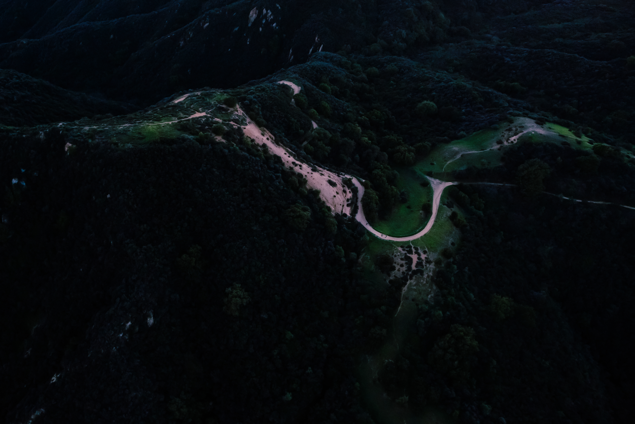
The line of the border is an abstract imposition upon a geographical reality. Drawn to scale, the thickness of the line belies actual places made of architecture, people, and histories. What does the border really look and feel like? The contributions to "part i: the border is (not) a line" ask us to examine, at close range, the physical fabric of the border.
Evoking the Canadian-US border at the famed Thousand Islands archipelago on the St. Lawrence, where sailboats drift between both sides of the border and passports are examined only upon landing, Gillian Tyrrell tells us that the border "hovers across a great history that predates it," and proceeds to recount the stories that make up the borderland. Borders are forged through historical events. At the same time, the lines on the map reveal little about the human experiences of the border: both the narratives that have shaped the border, and the events that result from the border's very presence.
That the border, initially an arbitrary delineation, begins to generate new landscapes is the subject of several essays. Lawrence Bird and Dongsei Kim both scrutinize the map as a tool. In Bird's project "parallel," which tracks the US/Canada border along the 49th parallel using satellite imagery, the map is a tool of perception. In "The First Iteration: Uncovering the Agency of Unknown Armistic Maps," (to be published May 26th) Kim shares obscure military maps from 1953 depicting the DMZ between North and South Korea and contrasts them with satellite imagery and narratives to reveal how the map operates as a political tool for representing territory. Architectural photographer Gili Merin identifies a "cartographic anomaly" created by the very discrepancy between the map and the place: as a result of how the much-contested border between Israel and Lebanon was mapped, Lebanon claims that thirteen enclaves are found on the "wrong" side of the border. Merin's photo essay (to be published May 26th) shows us the architecture that make up the border, inhabited architecture and landscapes that were specifically designed to fortify the border.
The late geographer, J.B. Harley warned of the interpretive nature of maps and mapping: “they are seldom read as ’thick’ texts or as a socially constructed form of knowledge.” Borders are layered in meaning and are the product of a struggle for control over space. Far from being neutral, they are prone to manipulation and used to legitimize ownership and maintain myths. Harley opposed the traditional dichotomous cartographic view of maps, a “string of binary oppositions between maps that are ‘ true and false’, 'accurate and inaccurate’, ‘objective or subjective’, 'literal and symbolic’, or that are based on ‘scientific integrity’ as opposed to ‘ideological distortion." Yet, the dichotomy of the map is entrenched in our understanding of borders --are you inside or outside the territory that the border controls?
Optimistically, many of our contributors reject this dichotomy. Borders have a fluidity that defy definition and demarcation, as Tyrrell points out in "The St. Lawrence River," and John Davis illustrates through an account of the conflicting legal language and metrics surrounding waters of the United States (to be published June 1st). Defying a conventional understanding of the border as a simple, binary dividing line, our contributors see the thickness and complexity of the border as an opportunity for new conditions. Sindhu Mahadevan imagines a new architecture for the contested border between India and Pakistan in "Osmotic Territories," (to be published June 8th), a border landscape of multiscalar infrastrucuture and living plants that challenge existing political narratives about the border. Draftworks Architect's speculative fiction, "The New Zidonians,"(to be published June 22nd) tells a story of how the border between Isarel and Palestine can become a new state, a place that can be inhabited, a place of freedom. These fictions bring us back to the importance of storytelling in defining and redefining borders.
The Site Magazine editor Ania Molenda interviewed Merve Bedir of Land+Civilization Compositions about her work with Syrian refugees in Turkey (to be published June 22nd), discussing how language and narrative, as much as physical spaces, shape the laws that govern borders, territory and whether you are considered inside or outside. Bedir emphasizes the need for utopias as we move away from the present, where national borders are dysfunctional and obsolete, towards a future where people can "live all together" despite the boundaries of nations. Land+Civilization Compositions' work seems to suggest that decisions about architecture and urban space can help create a reality where this sense of belonging is possible.
Borders are drawn as two-dimensional dividing lines on a map, and conceptually understood as such. We cannot ignore how this concept of the line on the map has shaped our relationship to territory, how the line has always been subject to political manipulation, how border lines are intrinsic to our cultural imagination. But borders are also more than lines. They are real, three-dimensional places: built of architecture and landscape, susceptible to the flows of wind and water and people, places that can be and often are inhabited. It is this awareness of the spatial qualities of the border that opens up possibilities for change.