Small Adjustments

Images by Sandra Smirle | Text by Miriam Ho
Satellites, planes, and drones are used to make much of the aerial imagery we are familiar with today, but their predecessor, kite and balloon mapping, is a technology that anyone can use to survey a landscape: simply tether a camera to a kite or weather balloon and take pictures of the ground. These ad hoc flying instruments offer a way to capture and democratize geographic data not collected or released by governments or corporations. In citizen science communities, map making with DIY aerial machines (from kites to drones) is a form of tactical activism, a way to reclaim the aerial commons and render the planet’s inaccessible or forbidden spaces legible. [1]

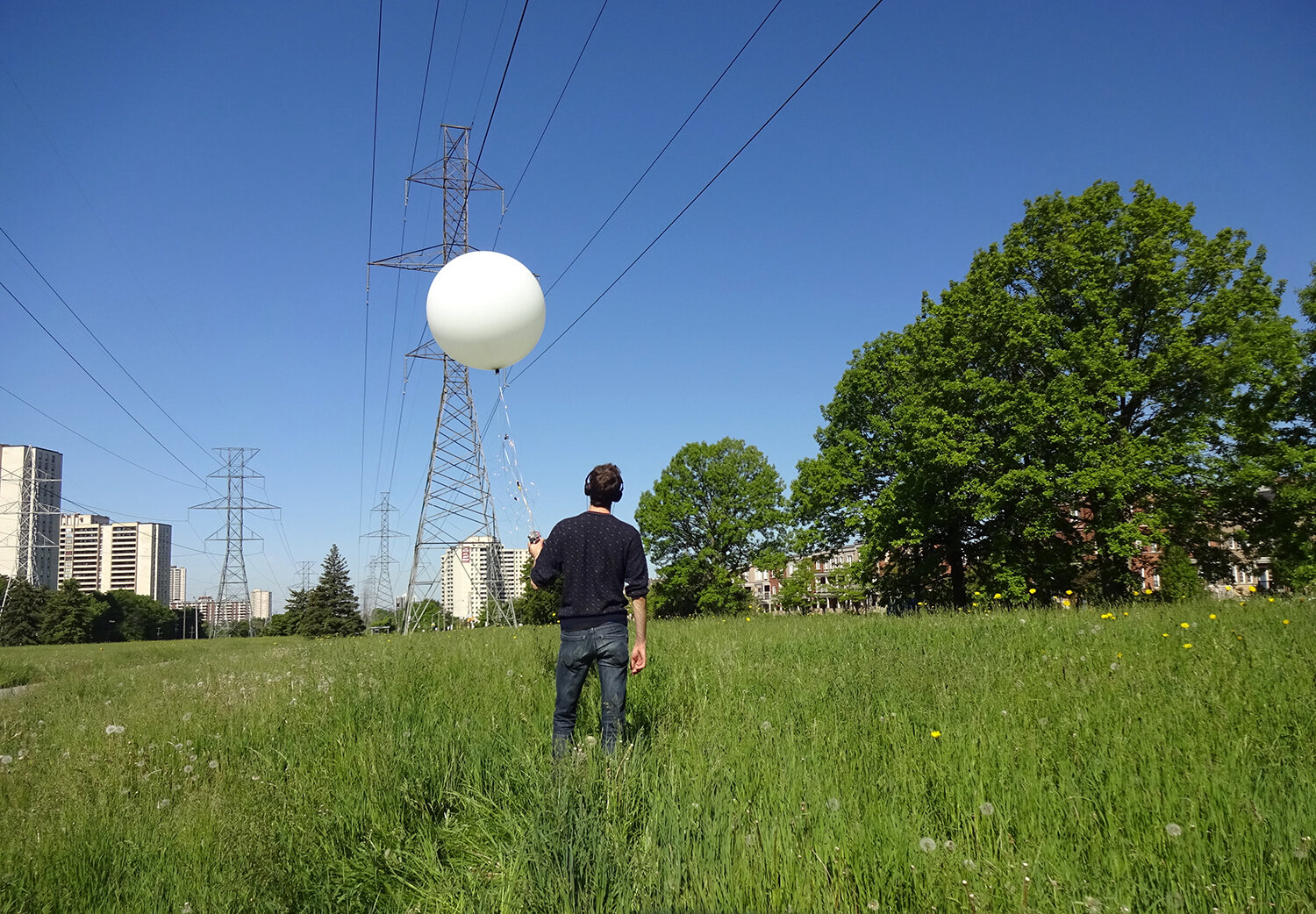
Field Notes and Test Flights, 2014. Photographs by Sandra Smirle
Aerial maps typically deal with an omniscient, macroscopic perspective, but what kite and balloon maps bring into view are necessarily an effect of the microscopic environmental phenomenon present at the time of documentation. Ephemeral devices subject to the whims of weather, kites and weather balloons rely on a delicate equilibrium of countervailing forces to take flight. For the artist Sandra Smirle, whose practice is preoccupied with surveying and surveillance, the cartographer’s tools are revelatory and complicit in producing the artifact of the map. Smirle writes, “I am struck by how the smallest adjustment of equilibrium, the smallest structural change, can be a radical proposition with astronomical consequences: a defining act of observation.” [2] Smirle uses the delicacy of this technology to capture fragile and fleeting moments in our ecological history: the eroding shoreline of the Toronto Islands, the tempestuous weather conditions of the Arctic at Svalbard. In a set-up mildly reminiscent of Winnie-the-Pooh, Smirle straps a GoPro video camera to a bright red helium balloon that swells and coasts on thermal air currents. The balloon bobs in and out of view as the camera spirals in unsteady circles and chaotic dives. There is a dizzying joy in the GoPro video, the heady excitement of child’s play. The imagery comes out of her attempts to direct the balloon to chart its vagrant trajectory from the ground. The resulting maps are less territorial delineation than a personalized narrative of ephemera.
Due to their limited coverage and high resolution, kite and balloon maps are ideal for producing hyper-local documentation. Citizen science initiatives have taken advantage of this to map in ways that are underrepresented in conventional aerial imagery. For instance, Public Lab, a non-profit DIY mapping group, was founded in New Orleans in 2010 to encourage members of the community, from fishermen to scientists, to document the Gulf Oil Spill.3 The organization has since expanded to encourage communities to monitor and map local issues including pollution and land-use. The visceral nature of DIY mapping goes beyond data collection towards an individualized understanding of the phenomena being observed.
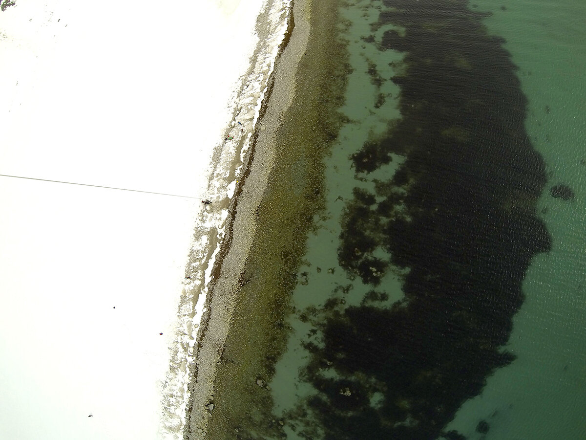
Field Notes and Test Flights, 2014. Photographs by Sandra Smirle
Notes:
1/ Jessica Breen, Shannon Dosemagen, Jeffrey Warren, and Mathew Lippincott, “Mapping Grassroots: Geodata and the Structure of Community-Led Open Environmental Science,” ACME: An International Journal for Critical Geographies 14, no. 3 (2015): 849–73, https://acme-journal.org/index.php/acme/article/view/1236.
2/ Sandra Smirle, email message to author, June 16, 2019.
3/ Nick Bilton, “Taking On the Gulf Oil Spill With Kites and Cameras,” New York Times, June 9, 2010, https:// bits.blogs.nytimes.com/2010/06/09/hacking-the-gulf-oil-spill-with-kites-and-cameras/.
Bio:
Sandra Smirle is a multidisciplinary Canadian artist based in Montreal, who uses drawing, sculpture, paper cutting, photo, video, and installation to explore ideas around surveillance, dataveillance, and our “viewer society.” Her work has been exhibited nationally as well as internationally and is held in private and corporate collections in Canada. She graduated with an MFA from Concordia University in 2015.