Gradually, Fiercely
Construction Documents for the Expansion of the SDF Fulfillment Grid In Louisville, Kentucky
By David Zielnicki
From the founding of Louisville, Kentucky, at the Falls of the Ohio River in 1778, the frontier city-cum-logistical landmark has capitalized on its geography for the expedient delivery of commercial goods. The city’s location was dictated by the Falls—the only natural obstruction along the Ohio as it flows from Pittsburgh, Pennsylvania westward to the Mississippi River. The obstacle provided an opportunity for a city structured around shipping industries. The subsequent expansion of railways and eventually air services found equal opportunity in Louisville’s siting midway between the Great Plains and the Atlantic. The city grew as a pivot-point for shipping between east and west. This position would be utilized throughout the twentieth century by retail giants Ford, DuPont, GE, UPS, and others. (1)
Today, UPS’s massive Worldport makes Louisville a pivot-point at a planetary scale. Serving as the global hub for the continental U.S., Worldport is UPS’s largest air facility and lies adjacent to (and dwarfs in scale) the passenger operations at Louisville’s SDF Airport. The facility can ship to 75 per cent of the U.S. population within two hours. (2) This expediency has attracted a bloom in e-commerce distribution centres within the last several decades. More than three million square metres of building footprint of e-commerce distribution centres can now be found in the Louisville metropolitan region. Most notably, Amazon’s SDF1 distribution centre, located south of Louisville, was the region’s largest from 1999 to 2007. The six fulfillment centres currently operated by Amazon in the SDF-vicinity make Louisville the site of Amazon’s highest density of shipping operations.
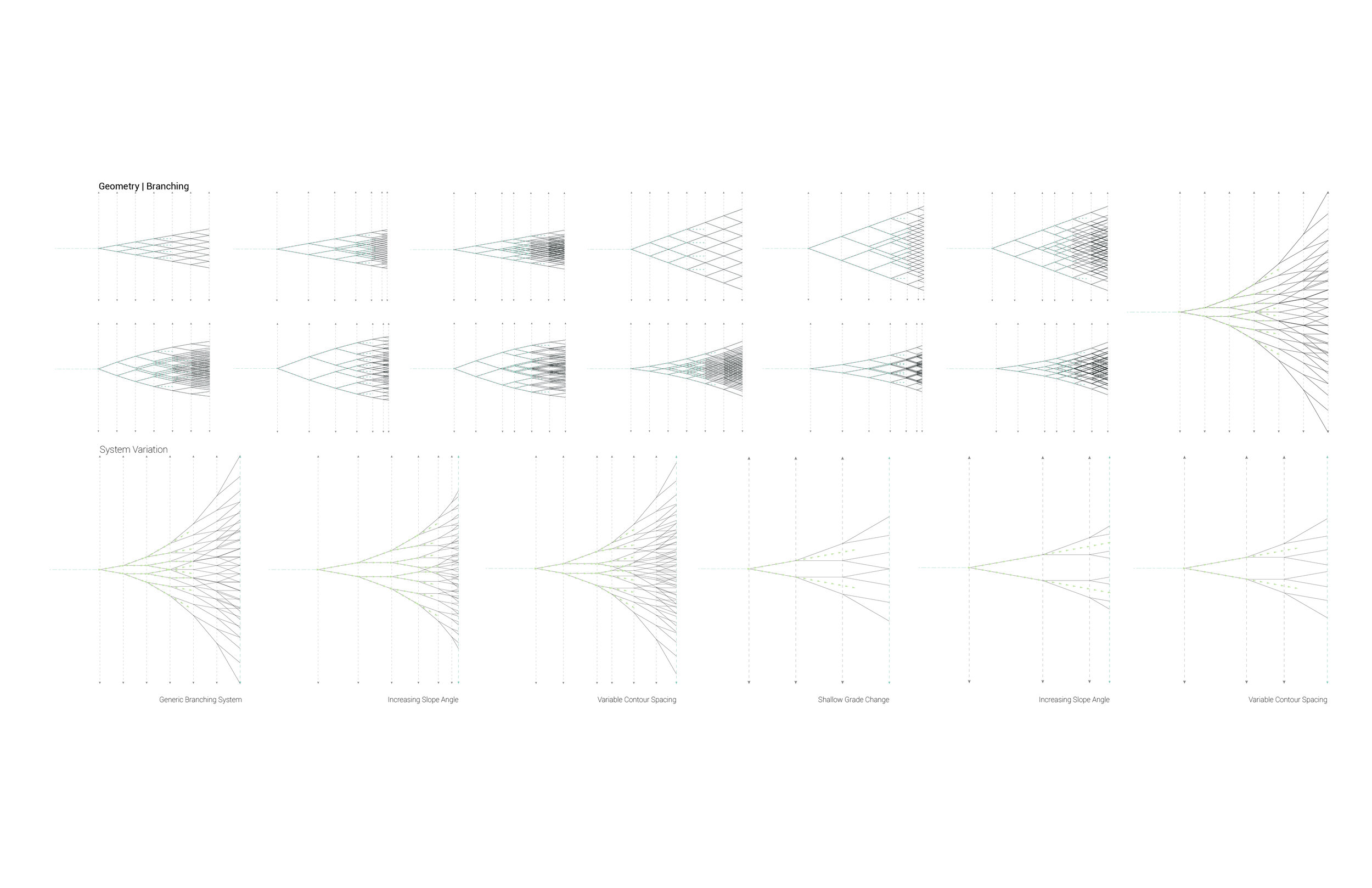
The construction documents presented here capitalize on this foothold to expand contemporary retail into the as-of-yet unrealized business of ecology. Thus far, the emergence of fulfillment networks has operated within existing settlement organizations, on the peripheries of urban centres, and has done little, if anything, to foster thriving communities. Fulfillment systems could even be seen as a detriment to thriving communities through the promotion of social isolation and energy consumption and a disavowal of the physical world. This project takes these trends at face value and matches the fields of logistics centres with the fields of conservation zones, agricultural land, and ecological remediation areas. Common ground is found in the matched tendencies towards increasing scales and decreasing human activity. Data-driven, automated consumer systems of scanners, robots, conveyors, drones, and maximum efficiencies are paired with ecological logics of species prioritization, large-scale land planning, and the movements of vegetation, animals, soils, and water. The images here assume the further evacuation of the countryside as the penultimate area for ecological production.

Corridor Intersections in the SDF Fulfillment Grid.

Typical Corridor Section

Variable Conservation Area Vegetation Transport

Ground-to-Air Corridor
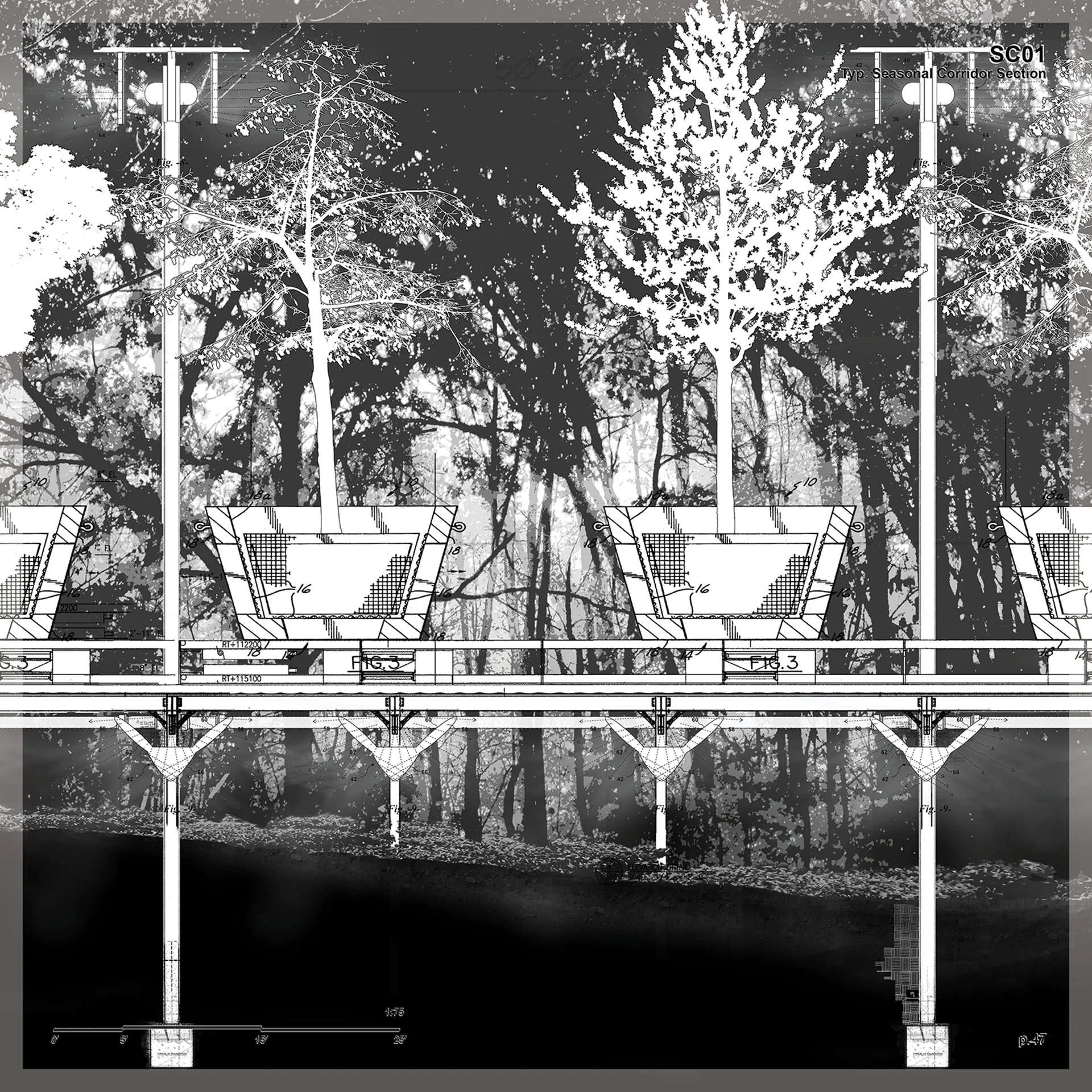
Typical Seasonal Corridor Section

Typical Corridor Section Detail

Variable Conservation Area Vegetation Establishment Detail

Typical Corridor Section Detail

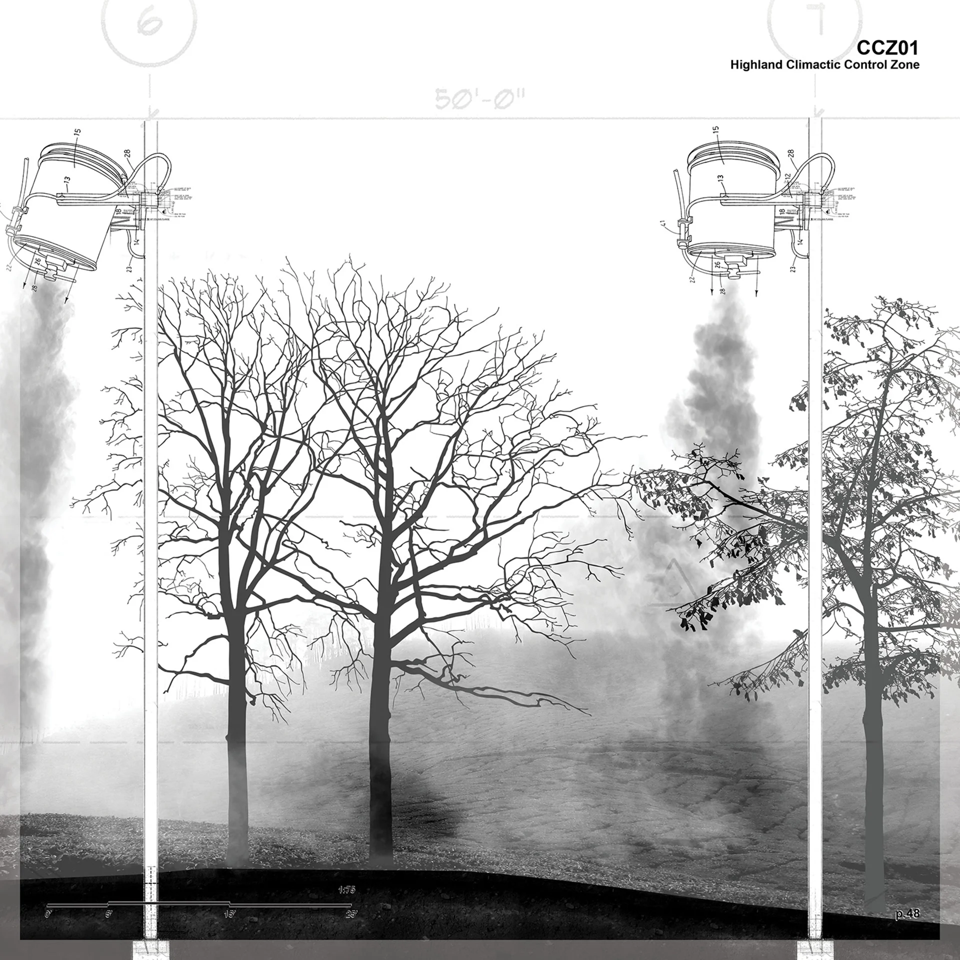
Climactic Control Zone Detail

Variable Conservation Area Soil Transport

Climactic Control Zone Footing Detail

Typical Data Farm Axonometric

Data Farm Section

Typical Waterways Axonometric

Typical Waterways Detail

Typical Forest Plan

Corridor Plan at Outlier

Typical Orchard Plan

Typical Corridor Plan
All images by David Zielnicki.
Endnotes
(1) Ford began operations in Louisville in 1913. Today, its truck assembly plant sits on a 72 hectare expanse outside of SDF Airport. GE’s Appliance Park is a 372 hectare manufacturing headquarters at the eastern edge of Louisville.
(2) Ghazal Jafari, “Geographies of Uncertainty,” Volume 47 (March 2016): 104–108.
Bio
David Zielnicki is an instructor at the School of Architecture + Landscape Architecture (SALA) at the University of British Columbia in Vancouver. Prior to joining SALA, David received his post-professional MLA II degree with distinction from the Graduate School of Design at Harvard University and his BSLA from Cornell University. David’s academic work is built on his previous position as a landscape architect at West 8 urban design & landscape architecture.